We slept in and woke to the alarm. Late enough so that we could just catch the late hotel breakfast. And it was a good one – with an automated waffle maker that pushed all my brain’s gadget buttons.
Next we headed to the pool to make up for the night before. It was indoors, on the cool side, and devoid of people. And, it had a big slide – more of a flume really. I think we each went down it once before it broke down. I told the desk, and they sent someone to fix it … and said we could check out late if we wanted to play for a while after it was fixed. I’m a big kid on a water slide, and I probably went down it a dozen times. Then we hit the hot tub. In the end, I don’t think we got out of the parking lot until 12:30.
I’d made Ben an offer that morning: we’d have to push hard in the evening, but we could probably fit in a touristy spot today. He already knew it was going to be Devils Tower. I’d been showing him the movie in case I could find the time to swing by there, and he’d apparently been looking at maps or brochures somewhere and knew it was close by.
Yes, I am spelling Devils Tower correctly (you can look it up) … but I’m not sure whether whomever named it got their spelling correct.
View Day 11 in a larger map
I also had to bite the bullet about routes. The major routes in the intermountain west tend to go northwest to southeast, following the Rockies. I needed to go northeast to southwest, and there aren’t any interstates going that way. So, I decided to go U.S. and state highways for most of the last two days. This had worked out OK in the midwest, and past experience had indicated that those are pretty good routes out west. The targets for the end of the day were Rock Springs, Rawlins, or Casper, with Rock Springs probably being too optimistic.
But, out of Rapid City, we continued on I-90, going towards the northwest, with the Black Hills on our left. They aren’t black, but they are darker than the surrounding plains, and they do contrast with the White Hills – the less well-known name of the badlands behind us. And they’re not hills – they’re small, jagged, nasty-looking forested mountains.
It drizzled all day. Nearly a perfect drizzle: no sun in my eyes while driving, and perfectly lubricated wipers set on the longest intermittent delay. In a little over an hour, we got off I-90 to drive the 30 miles or so to Devils Tower.
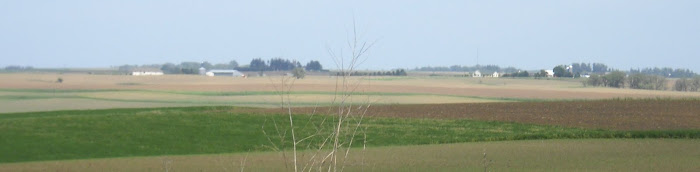
Since it isn’t in South Dakota, it isn’t readily apparent from a map that it’s at the northwest tip of the Black Hills. But the long distance views confirm that there are other buttes and peaks of similar size in the area.
Devils Tower is a national monument, so the gift store did not thrill Ben.
The model in the gift shop cried out for Richard Dreyfuss though.
This is the view you get from the door of the gift shop.
The hike thrilled both of us. It starts right at the parking lot, and heads off into tall, pine woods on an asphalt trail.
I've learned from movies that the Lakota view the Black Hills as sacred, but at Devils Tower they really take it seriously.
Prayer cloths and bags like these were scattered all through the woods visible from the trail.
I took a ton of pictures – the trail had great sight lines, and every time you looked up it seemed like the Tower had changed. It has a greenish tone to it, and distinct grooves and columns; we thought that it looked like the asparagus of the gods.
These boulders have fallen off the side of the tower. In the tower, they are columns, but when they fall it is easy to see that they are prisms, with flat edges and clearly defined angles.
Here's an explanation of the sharp edges and angles.
This is taken from around the other side of the tower, but looking up you can clearly see how it is composed of a bunch of prisms, like a faggot of sticks bound together with no rope.
This formation is towards the top.
Here's a close-up of the same formation where you can really see the polygonal ends of the prisms.
On the east side of the tower you couldn't see out of the forest.
As you came around the west side of the tower, there were openings to see into the distance. Not much to see though, as you’re looking away from the Black Hills. On a clear day I’d think you’d see the Big Horn Mountains out there in the distance.
You can tell that my lens was getting a bit damp from the drizzle.
If you enlarge this, and look closely, you can see the remains of climbing ladders and gear from the first attempts to summit Devils Tower about 100 years ago.
The guy on the left is looking through a mounted telescope, through which you can pick out the ladders fairly easily.
Ben hiking amongst the boulders at the base of Devils Tower.
King of the hill
Ahead of us is one of the biggest pieces of column that we saw.
I should have had Ben stand by this for perspective, but the lower edge right in front of the trail was about 4 feet off the ground, and the top edge was more like 15. Ben couldn’t find a way to get up this rock.
He did find a way to get to the top of this one.
You can’t see the surface of the top of the tower, but from this angle, you can definitely see that it slopes away in the other direction. The guide says that it is a fairly flat meadow up there.
These looked like wild snapdragons.
We left the national monument around 4, and hit a souvenir store right past the border. Now they had some exquisite crap – all sorts of alien and close encounters nonsense. They even had an “alien baby” in a big pickle jar filled with what looked like windex. I laughed so hard, and asked them how much it was. They said it didn’t have a price, no one had ever offered to buy it, and they’d have to call the owner. I told them not to bother.
It was half-an-hour back to the interstate, and we crossed over the Belle Fourche River. It’s mostly 10-20 fee wide, but it looks deep, and it meanders like nothing I’ve ever seen. We crossed it a few more times before hitting I-90. From there it was half-an-hour more to Gillette, with a bridge over the Belle Fourche River along the way. Ben had a hankering for a fish sandwich at McDonald’s, so I made him a deal that I would stop if he ate in the truck while I got gas. That saved us a few minutes, which was a good thing since the main drag at the exit was completely torn up with widening and construction.
We headed south in the drizzle on Wyoming 59. Staying on I-90 would take us too far west to catch I-25, and then we’d have to follow that back to the southeast. This road went due south. The traffic was heavy but fast. We were in serious coal strip mining country, and it was all guys in pick-up trucks. We crossed the Belle Fourche river again. And again. And again. We also took some bridges over railroad tracks with long coal trains on them. Most of the trucks turned into a big operation at a crossroads village named Wright. They turned left, and we turned right.
We saw our first Wyoming pronghorn there, and I took this picture.
I’d seen pronghorn once up close, and a few times in the distance near Cedar City. When I did I’d researched up these bit of trivia. Americans call them antelope, but they aren’t. Antelope are restricted to the old-world, and more closely related to goats, sheep, and cows than deer. Pronghorns aren’t even deer. They are in the same infraorder as those mammals, along with giraffes, but they are the only non-extinct member of their own family that evolved separately in North America to fill the same niche that those other animals filled in the old world. Pronghorns have a real problem with man: they move by bounding forward instead of up, so just about any sort of fence completely stops them. There aren’t many fences in Wyoming, and there are a lot of pronghorns.
Now we headed southwest on Wyoming 387, and we only saw a vehicle coming our way every 10 miles or so.
Of all things, this Fed Ex truck was in front of us for the longest time. He was hauling a**, and was hard to catch and pass. It reminded me of seeing a UPS truck in the middle of nowhere with Mary Jo back in the early 90’s.
There were many more pronghorns. And, we crossed the Belle Fourche River a few more times before finally leaving it behind.
We met back up with I-15 after 110 miles, having cut off 50 miles of interstate. We were now on the main north-south corridor through Wyoming, so it was exurban until we got into Casper. We stopped for a coffee and gas there around 6:45. I got a little nervous that I’d missed our exit because of how much of the city we had to go through to get to our next exit.
We headed southwest again on Wyoming 220, since I-25 was now going southeast towards Laramie and Cheyenne. We passed the biggest ranch we’d ever seen: miles of white vinyl horse fence, before a big gate, and then a few more miles of horse fence. The place easily had 10 miles of frontage on the road, and no back end in sight, so it probably was a few hundred thousand acres.
I had no listing of other sites on this road. I wish I had, and that it was a bit earlier. First we passed Independence Rock. It looks a bit like Ayers Rock in Australia. This was a landmark on the Oregon Trail: you had to reach it by Independence Day if you were going to make it to Oregon before the snow hit. Next up was Devil’s Gate, another trail landmark that I’d heard of.
Last was Martin’s Cove. That place is a big deal to Mormons. Mormon pioneers in the 1850’s were often so poor that they brought handcarts – rather than wagons – across the plains. In 1856 a handcart party left the east too late in the season, and was trapped in Martin’s Cove by a blizzard in early November. About a third of the party died, and Brigham Young had to send out a rescue party. It’s now popular among Mormons to take a summer “vacation” to Martin’s Cove to reenact the handcart experience.
After that, we turned onto U.S. 287, which wasn’t as nice a road as the Wyoming highways we’d been taking.
We pulled into Rawlins just before 9, after cover over 400 miles for the day – 300 since Devils Tower. My gamble on taking 2-lane roads had paid off: the roads were fantastic, the traffic was light, and the route saved us a lot of time. We were game, but 100 more miles to Rock Springs on I-80 didn’t seem worthwhile. Plus, I was thinking of going to Dinosaur National Monument the next day, and if we went to Rock Springs, we’d have to backtrack 20 miles or so to get there. We checked into a motel, hit the pool, and went to bed.
No comments:
Post a Comment